Monday 13 May 2024, 09:34 - Last updated: 14:07
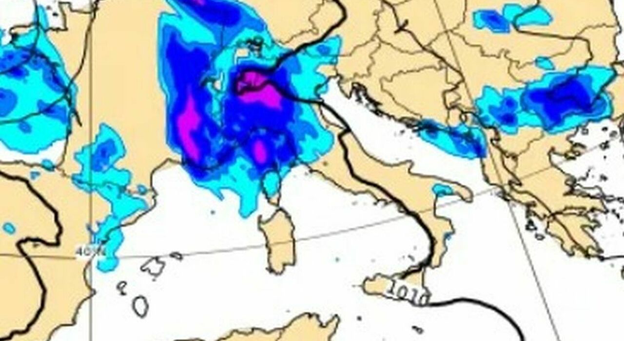
After a weekend characterized by stable conditions and mostly warm temperatures, which in some areas decidedly heralded the summer, the weather in Italy is set to undergo (again) a marked change. Starting today, Monday, May 13th, an intense wave of autumnal bad weather, originating from the Atlantic, will begin to make itself felt over much of Central and Western Europe, continuing throughout the week. Conditions will vary across different areas of the Peninsula, with Italy somehow split: bad weather in the North, intermittently in the Center, and decidedly more stable in the South. From the standpoint of temperatures, the impact of the rainfall will cause a decrease, bringing the values below the average in the northern regions. On the contrary, in the central and southern regions, temperatures will be above average (in the South even above 30°C).
According to 3b weather, the most affected areas will be the northern regions of Italy, where a low-pressure vortex, coming from the United Kingdom, will bring frequent disturbances. This change in climate marks the beginning of a new rainy phase fueled both by the cool North Atlantic currents and by the warm currents coming from North Africa, a combination that will give rise to intense meteorological phenomena, mainly in the form of thunderstorms, with a concrete risk of downpours and hail (always in Northern Italy). As for the central regions, they will be affected by unstable passages that could be locally significant, especially in Tuscany, Umbria, Marche, and occasionally along the Apennine ridge between Lazio and Abruzzo. Southern Italy, instead, will remain more protected within an anticyclonic bubble, with only some more stratified cloudy disturbances and fewer significant phenomena.
The series of disturbances will start today (Monday, May 13th), with the first more intense phenomena expected on the Alpine and Pre-Alpine sectors, while some thunderstorms may also affect the plains, particularly in Piedmont, Lombardy, and Friuli. A second disturbance will follow between Tuesday and Wednesday, with the peak of adverse weather conditions expected for Wednesday, when some areas of the North may register precipitation exceeding 120/150 mm and potential local criticalities. A third disturbance, scheduled for Thursday, will predominantly cross the North, proposing similar conditions. Even the day of Friday, 17th, and the weekend of 18-19 May could be characterized by marked instability with also disturbed weather in the north of Italy.
On Monday, May 13th, marked instability on the Alps/Pre-Alps and foothills with showers and thunderstorms, locally intense and partially extending to the surrounding plains. Temperatures dropping (maximums between 21 and 26 degrees). In the Center, partly sunny skies on coasts and coastal hinterland, some daytime thunderstorms along the Apennine. Temperatures stable, maximums between 22 and 27 degrees. In the South, sunny or at most veiled, except for greater afternoon variability on the internal Apennine areas with isolated phenomena. Temperatures rising, maximums between 23 and 28 degrees.
On Tuesday, May 14th, weather occasionally unstable from the morning with intermittent rains, intense worsening by evening in the Northwest and Lombardy with strong thunderstorms. Temperatures slightly dropping, maximums between 20 and 25 degrees. In the Center, according to 3b weather, scattered clouds and clearings with some isolated afternoon thunderstorms in the Apennine with local spillover to the Adriatic. Temperatures stationary, maximums between 22 and 27 degrees. In the South: predominantly sunny with some veiling or stratification and sporadic daytime showers in the Apennine. Temperatures rising, maximums between 25 and 30.
On Wednesday, May 15th, disturbed weather with showers and thunderstorms also strong and locally of downpour nature with possible hail in the North. Temperatures further dropping, maximums between 18 and 23. In the Center: situation occasionally unstable between Tuscany, Umbria, and Marche with some showers or thunderstorms, greater openings elsewhere. Temperatures locally decreasing, maximums between 23 and 27 degrees. In the South, sunny weather expected, except for veils or stratification advancing from the west and some disturbance in the Apennine. Temperatures rising, maximums between 25 and 31 degrees.
On Thursday, May 16th, in the northwest, scattered clouds with wide clearings on the Ligurian coast, scattered clouds with wide clearings on the Lombard-Piedmont plains, covered with moderate rain on the western and central Alps. In the northeast, instead, scattered clouds with wide clearings in Romagna, covered with moderate rain on the Dolomites, covered with light rain elsewhere. In the Center: clear on the Capital and on the Gran Sasso, scattered clouds with wide clearings elsewhere. In the South, scattered clouds with wide clearings; clear on the Costa Smeralda and on the internal Sardinian areas.
© ALL RIGHTS RESERVED
This article is automatically translated
