Wednesday 24 April 2024, 14:19 - Last updated: 20:08
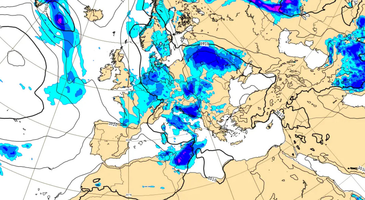
Storms and hail over Italy, even for the April 25th holiday. The bad weather of these days will indeed continue into the next weekend, bringing rain and instability across the peninsula. Once again, Central and Southern Italy will be affected, while the North of the country will see a gradual improvement in weather conditions. However, temperatures will rise well above the seasonal averages. Hail in Rome today: where and when it rains. The weather forecast for the coming days continues the bad weather over Italy. After the rain of these days, the meteorological instability will play a leading role for the April 25th bridge as well, with rains and storms across much of the peninsula. Despite this, starting from Thursday, April 25th, the influx of Arctic currents towards the central Mediterranean will gradually begin to reduce, with temperatures starting to gain a few degrees in the maximum values in the Center-North. According to 3BMeteo forecasts, a further reduction in the Arctic influx is expected for Friday with a general recovery in temperatures, but there will be a gradual deterioration of the weather starting from the Northwest, due to the approach of a front of Atlantic origin. Thus, the bridge will be characterized by instability, from North to South Italy. If the rain will continue in the coming days, the same cannot be said of the cold. The last weekend of April will indeed bring with it a significant rise in temperatures, which will affect much of the country. The abnormal cold of these days will become just a memory and indeed in Italy the values could return to above the averages of the period sooner than we think. On Thursday, April 25th, according to 3BMeteo in the North scattered clouds will alternate with clear spells, except for greater cloudiness over Friuli Venezia Giulia, upper Veneto, and the Emilian Apennines, associated with some more frequent showers from the afternoon, locally spilling over to the Via Emilia. Some snow is also expected on the Apennines above 1100 meters. In the Center, scattered clouds and clear spells in the morning except for cloudiness over upper Tuscany. During the day, an increase in instability over the inland areas with scattered showers also stormy and locally accompanied by hail, locally spilling over to the Adriatic coast but diminishing in the evening. In the South, a fairly sunny morning, except for cloudiness and some rain on the Tyrrhenian Calabria and Messina. In the afternoon, cloudiness and some rain or showers on the peninsular Tyrrhenian areas and on the inland areas in general, locally spilling over to the central-northern Puglian coast but diminishing in the evening. In Sardinia, variability in the morning with some rain on the western side, then improvement. Instability also on Friday. In the North, initial clear spells except for cloudiness in the Northwest. It worsens during the day in the Northwest with scattered rains over Liguria and Piedmont, extending to Lombardy and by evening to Emilia and western Veneto, with weak intensity. Sprinkles of snow on the western Alps from 1200/1400m. In the Center, partial clear spells in the morning, then clouds increasing in the afternoon with some showers over the inland areas locally spilling over by evening to the Marche coast and subsequently diminishing. In the South, irregular cloudiness and some rain in Campania, diminishing over time, elsewhere mostly clear and dry. Slight improvement on Saturday, when the Arctic influx will be attenuating, especially in the Center-South. In the North, cloudy over Northwest and Lombardy with more frequent rains and showers in Liguria, initial clear spells over Triveneto and Emilia Romagna but with clouds increasing during the day and some rain arriving over Trentino Alto Adige, western Veneto, and Friuli Venezia Giulia. Weak snowfalls on the central-western Alps from 1200/1500m. In the Center, some rain in the morning in Tuscany, diminishing during the day with a tendency for clear spells. Elsewhere drier weather with wide clear spells also on the Adriatic side. In the South, stable weather and mostly sunny, except for some variability over the Apennine areas in the afternoon. On Sunday, in the North, cloudy over Piedmont, Aosta Valley, and Lombardy with scattered rains and showers, gradually diminishing during the day. Greater clear spells in Liguria, Emilia Romagna, and Triveneto. In the Center and South, conditions of stable weather and generally sunny. Temperatures further increasing, maximums up to 24/25°C on the central-southern Tyrrhenian regions, Sicily, and Puglia, higher in Sardinia.
© ALL RIGHTS RESERVED
This article is automatically translated
