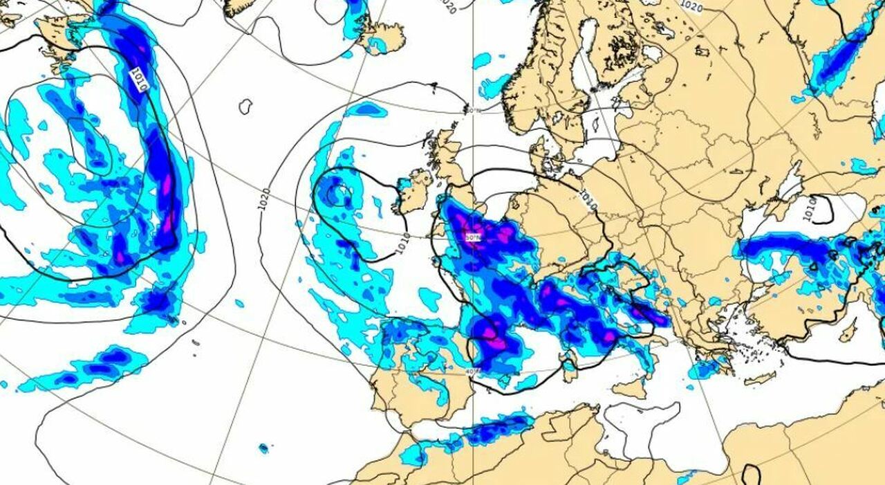
Bad weather is on its way to Italy. An Atlantic disturbance is moving towards our Peninsula. In Spain, it has been dubbed "Storm Sancho." It will have a lesser impact here, but it will still bring rains with the risk of strong thunderstorms. Several events, moreover, have been canceled on May 1st precisely because of the adverse weather. Let's look at the forecasts. Where and when it will rain.
Bad weather in Rome, where and when it rains on May 1st: weather forecasts for the coming days
Where and when
"Tomorrow afternoon, first rains on Piedmont, Tuscany, and Sardinia, then in the evening scattered rains (at times also intense) throughout the Northwest and more isolated also on Tuscany, Umbria, Sicily, and Sardinia," said meteorologist Andrea Giuliacci to Adnkronos, highlighting that "this same disturbance then on May 1st will bring widespread bad weather, with rainy moments, throughout the day, across much of Italy, although there will also be temporary clearings, especially on the Adriatic side." "Thursday still numerous showers and thunderstorms in the North, Tyrrhenian regions, and Islands, then on Friday a partial improvement, with less rain mostly concentrated on the inland areas of the Center-South during the central hours of the day. Then on Saturday and Sunday, it will be nice almost everywhere: new moderate worsening only at the end of Sunday in the North. Temperatures: tomorrow a bit of unseasonal warmth, with afternoon temperatures above the norm throughout Italy, in many locations typical of June; then between Wednesday 1st and Friday 3rd, a sharp and widespread drop in temperature: a bit of cold will return, with temperatures again below the norm," concluded Giuliacci.
The forecasts for Tuesday, April 30
On Tuesday, clouds will increase in the Northwest and on Sardinia with some showers or more likely thunderstorms from the afternoon. Still predominantly sunny elsewhere but with a tendency towards some rain also on western Sicily and upper Tuscany in the evening. Temperatures will tend to decrease slightly from the west, will still be stable and with a summer feel in the east. The wind will be moderate at times strong from the Scirocco.
The forecasts for May 1st
On Wednesday, May 1st, the disturbance associated with the cyclonic vortex will reach all of Italy bringing rains and thunderstorms, even intense in the Northwest, western Lombardy, western Emilia, major Islands, central Tyrrhenian strip, and Campania. The Triveneto, Emilia and eastern Lombardy, and Romagna will remain temporarily more protected from the bad weather, which will be more interested in the evening while the lower Adriatic and the Ionian will see fewer phenomena. Temperatures will generally decrease, the wind will be tense from the southern quadrants.
The forecasts for May 2nd
On Thursday, the weather will still be markedly unstable or disturbed in the Center North with rains, downpours, and thunderstorms locally of strong intensity. Partly unstable weather also in the South, essentially Campania and the lower Tyrrhenian with a possibility of thunderstorms. Elsewhere, there should be more openings. Temperatures will tend to decrease a bit more, bringing them below average in several regions. The wind will remain tense or strong from the southern quadrants.
The forecasts for May 3rd
On Friday, there will still be some instability, albeit with a less intense character in the Center and South with a possibility of brief showers or thunderstorms but in a context that will also allow for some clearings. The North, especially the Northwest, should experience more sunshine. Temperatures will not undergo significant changes, the wind will be tense from the western or southwest quadrants.
This article is automatically translated
