Thursday 18 April 2024, 08:27 - Last updated: 19 April, 10:17
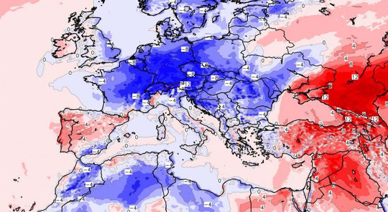
Still cold over Italy. After the anomalous heat that characterized the first part of April, setting temperature records across Europe, a wave of cold air will reach our peninsula, bringing also an increase in instability, especially in the Central-South.
Weather in Rome, where and when will it rain? Risk of thunderstorms, the latest weather forecasts
From record heat to cold wave
The thermal anomaly of the first two weeks of April has given way to a new wave of cold. After a historic first part of the month, with temperature records both in the plains and in the mountains, a new thermal drop will hit Europe, bringing cold and bad weather to all the nations that until a few days ago were affected by the effects of the powerful anticyclone, such as France, Spain, Austria, Switzerland, Slovenia, Croatia, Slovakia, Bosnia, and Italy itself. According to 3BMeteo, a new disturbance will bring a drop in temperatures of over 15°C. The cold air, which will not be as exceptional as the heat, will partly reach our Peninsula also bringing an increase in instability. The precipitation will mainly affect the Central South, especially the eastern slopes. This fact, however, is normal being spring. If there were not hundreds of heat records, a frequent number of off-season heat waves, a number of records broken by a wide margin, positive anomalies involving large areas of Europe, there would indeed be nothing strange in seeing ups and downs in spring.
The Cyclone Gori arrives in Italy, where and when it will rain: risk of strong thunderstorms. Weather alert in 6 regions
Rain Returns
However, not only the cold has returned. The entry of cold air into the central Mediterranean basin has indeed brought with it also strong winds - Bora over 100km/h on the Triestino - and a storm front, which since yesterday has hit the northern regions bringing rain accumulations up to 50mm in Friuli, many damages and a sudden lowering of the snow line on the Alps. According to 3BMeteo, at the same time, an Afro-Mediterranean low passed over the southern regions with abundant rains between Sicily, Calabria, and lower Campania up to 50mm.
During the night, however, the African low gradually exited the scene while the cold front continued its march southeast. Some showers, also stormy, affected the middle and lower Adriatic and occasionally the lower Tyrrhenian but with not significant accumulations since the main target of the bad weather was the Balkan area. However, in the next few hours, the flow of cold air will continue to stimulate a certain instability in the southern regions. This front will have greater consequences in terms of instability because it will form a low-pressure minimum over the Tyrrhenian area that will also bring local bad weather conditions, until Friday.
Thursday 18, the forecasts
On Thursday 18th, in the North irregular cloudiness from the morning but with phenomena overall isolated. Afternoon with more widespread instability between lower Piedmont, Liguria, lower Lombardy, Emilia Romagna, and Triveneto with the possibility of showers and locally moderate thunderstorms associated with hail. Snow on the western Alps and the Apennines below 1000m in the evening. In the Center, irregular cloudiness from the morning with showers and some thunderstorms, more likely between high Tuscany and Marche. In the afternoon widespread instability with showers and locally moderate thunderstorms associated with hail. Snow in the Apennines dropping to 1200m in the evening. Finally, in the South, irregularly cloudy sky with showers and thunderstorms possible from the morning between Campania and the lower Tyrrhenian, then more widespread and locally moderate between the afternoon and evening with the possibility of hail. Less instability in Sicily and Sardinia, but in Sardinia at the end of the day possibility of strong thunderstorms. Temperatures further decreasing everywhere. Winds strong or tense, seas very rough or agitated with local storm surges on the exposed coasts.
Friday 19, the forecasts
On Friday, in the North clear or partly cloudy sky with residual disturbances in the morning on Romagna. In the Center, still some thunderstorms between Marche, Umbria, and Abruzzo gradually diminishing from the afternoon, more openings on the Tyrrhenian strip with last phenomena in the morning on lower Lazio. Snow in the Apennines around 1000m. South, bad weather with showers and thunderstorms also strong and frequently associated with hail. Greater openings on Sardinia and southern Sicily. Snow in the Apennines between 1100 and 1500m. Temperatures further decreasing in the Center South. Winds strong or tense in cyclonic rotation. Seas very rough or agitated with local storm surges.
© ALL RIGHTS RESERVED
This article is automatically translated
