Tuesday 16 April 2024, 18:40 - Last updated: 18 April, 09:37
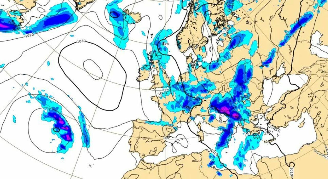
Cyclone Gori is on its way to Italy. Several weather alerts have been issued in various regions by the civil protection authority. The Military Aeronautical Meteorological Service has indicated that there will be "intense phenomena." The second half of April will experience below-average temperatures and snow in the mountains. Lorenzo Tedici, a meteorologist from the website www.iLMeteo.it, predicts an extreme weather reversal: after enjoying a summer climate with peaks of 32-33°C even in the North, a rather long, similar-to-winter period is about to return.
La Nina is coming, earthquake risk? Where, when, and why it can lead to extreme events.
The sub-seasonal weather trend confirms that the entire second half of April will be characterized by temperatures below the period's average, contrary to what has happened so far in this very hot 2024. In addition to below-average thermal values, we will also have frequent rains until the end of the month: in fact, a reversal is coming with a Scandinavian incursion and a drop in temperatures up to 15°C in the maximum values, locally we will also have 17 degrees less compared to the exceptional summer heat of the weekend.
In detail, the polar air will descend from Scandinavia rapidly, entering Italy in the next few hours: the first effects will be observable in the North-East with thunderstorms and possible hail, while in the South we will still have the remnants of a North African depression with some scattered rain.
The real drop in temperatures will begin in the evening and will affect the whole country on Wednesday, April 17: the drop will be more marked on the eastern side, the maximums will drop widely below 20°C. From 33°C to 16°C, from summer to autumn, with similar-to-winter features. Snow will also return on the Apennines up to 1000 meters above sea level. In addition to the Alps, the mountains from Tuscany to Molise will turn white again.
In detail, from the next few hours, strong thunderstorms are expected in the North-East and scattered rains in the South, elsewhere we will remain in patient anticipation of the Scandinavian incursion and the reversal.
Wednesday, April 17, will see a more widespread worsening in the Center-South with precipitation predominantly in the form of showers or thunderstorms: the North will remain temporarily protected by the Alpine chain, without significant rains but already with an important drop in temperatures.
Thursday, the formation of a cyclone over the Tyrrhenian Sea is expected due to the influx of cold air: the precipitation will be snowy on the Apennines beyond 1000 meters. Showers and thunderstorms will affect the entire Boot in a patchy manner, leaving only the Major Islands clear and drier. Snow will also be widespread on the Alps beyond 900-1100 meters.
Friday will be a photocopy of Thursday with boots and skis ready on the Apennines and the Alps: snow will still make its appearance at exceptional altitudes for the period, up to 900-1000 meters. The only differences compared to Thursday, the lesser precipitation in the North and in Tuscany and the greater rains on Sardinia and Sicily.
For the weekend weather, it is still too early, but in general, the temperatures will remain below average, some showers will still wet the North-East and the Center-South in a similar-to-winter context suitable for out-of-season skiing.
From the first hours of tomorrow, gale-force winds, with local gusts up to strong gale, will lash Sicily and Calabria. Possible storm surges along the exposed coasts. This is indicated by a weather alert issued by the Civil Protection. An - always for tomorrow - yellow alert is assessed on part of Emilia-Romagna and Campania and on Calabria, Basilicata, Molise, and Puglia.
The yellow alert (ordinary risk) issued by the Lombardy Region's Functional Center for natural risk monitoring for wind in Milan continues until midnight today, Tuesday, April 16. It is recommended during the alert period not to stay under trees in parks and tree-lined avenues and near construction site scaffolding, outdoor areas, and tents. It is also important to secure objects and pots on balconies and all artifacts that can be moved by the wind. The municipal civil protection operational center (Coc) is active for monitoring any critical issues.
© ALL RIGHTS RESERVED
This article is automatically translated
