Saturday 20 April 2024, 11:38 - Last updated: 21 April, 11:27
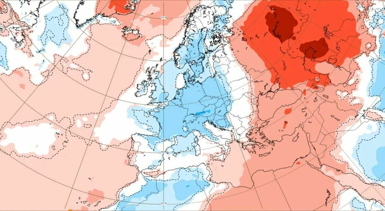
Arctic cold and snow for the April 25th holiday. After the summer heat of last weekend, a phase akin to winter arrives. Andrea Garbinato, head of the editorial team at www.iLMeteo.it, predicts that the long 'Sweden-Italy' meteorological corridor will remain open for at least another week or even more. Until April 25th, and probably even until May 1st, colder air from Northern Europe will reach Italy: temperatures will remain below the average for this period, and thunderstorms will be very frequent. Thunderstorm in Rome today, when and where: the weather forecast for the weekend. Drop in temperatures. Where it will snow: In detail, the next few hours will see a further deterioration with precipitation from North to South, more intense in the central regions and the southern peninsula: on the Apennines, we will find out-of-season snow beyond 1200 meters with a fairy-tale landscape deep into spring. Thunderstorms will be more intense on the Adriatic side and towards the Lower Tyrrhenian, while in the North-West and Sicily there will not lack broad clearings and dry periods. The drop in temperatures: The wind will still blow strong from the Northwest on Sardinia, and the highs will not exceed 19°C even in the South; the only exception is Sicily with 23-24°C in Syracuse and Catania. In the North, the highs will instead drop to winter-like values with just 12°C in Bologna and Venice. On Friday, the bad weather will move towards Greece, but it will still hit the entire South and the Middle Adriatic: weather conditions will also worsen in Sicily with some showers and strengthening of the wind. In the Middle Adriatic, we will find snow in the inland areas, on the central Apennines isolated flakes will fall down to 1400 meters. In the North and the rest of the Center, we will instead experience a meteorological respite with improving weather. Cold wind: The weekend will still be typical of a month we could call 'AprilJanuary', a mix between April and January, with decidedly below-average winter-like temperatures: the arrival of a second cold impulse from Northern Europe is expected with more widespread phenomena in the Center and with more significant snowfalls on the Central Apennines beyond 1000 meters; also in parts of the north and locally in the southern sector, there will be local thunderstorms, while in Sardinia, Sicily, and the North-West broad clearings are expected. In summary, let's prepare for a stormy period with frequent 'squalls': the calm of last weekend is just a faded memory, now the wind and thunderstorms will remind us that Spring in Italy often shows its colder and stormier face. The forecasts: Saturday 20. In the north: sunny, clouds in the Northeast with local showers. In the center: bad weather. In the south: initially good then worsens from the evening. Trend: second Scandinavian impulse with disturbed and cold weather for the period. Still scattered showers at least until April 25th.
© ALL RIGHTS RESERVED
This article is automatically translated
