Monday 22 April 2024, 07:18 - Last updated: 15:53
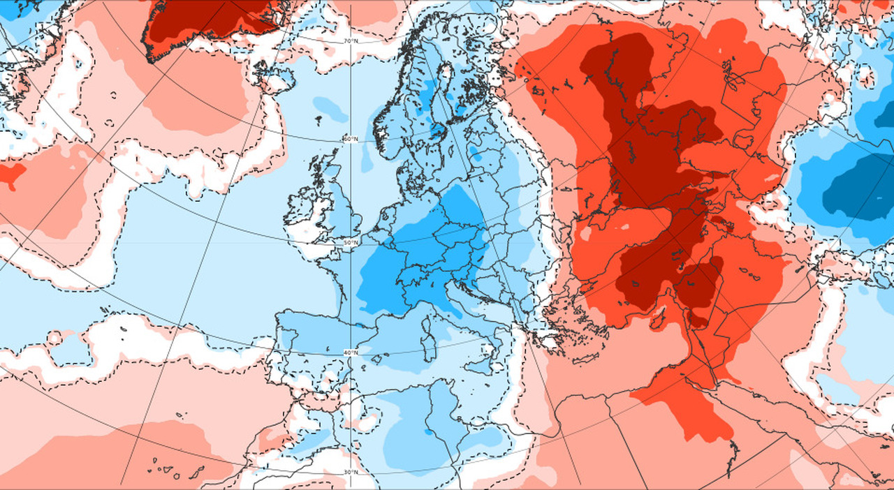
A flow of maritime Arctic air currents will continue to move towards Western Central Europe without delay, feeding secondary depression systems. This will still happen at the beginning of the week when the cold air will enter the Mediterranean from the Rhône Valley, stimulating the formation of a low-pressure vortex over the Northern Tyrrhenian Sea. A winter-like configuration that, in addition to bringing bad weather, will further lower temperatures, dropping the snowfall levels to unusual levels for the period. Cold and snow in Valtellina and Valchiavenna, hit by a wave of bad weather, with scenarios of full winter. On some slopes, skiing is still possible with daytime temperatures up to 6-7 degrees below zero, which at night drop to -10/11. In the past hours, the snowfall limit has dropped to 600 meters. All the peaks surrounding the capital Sondrio and the other localities are snow-covered.
Monday
So, a Monday characterized by showers, thunderstorms with possible hail, and snowfalls that could fall to low altitudes in Piedmont (even below 400m) is to be expected. The minimum will also involve most of the central regions while having difficulty reaching the South where there will be a temporarily milder influx.
Tuesday
On Tuesday, the cold vortex will continue to maintain its position over the central northern regions while the inflow of cold air sliding towards Algeria and Tunisia will stimulate the birth of a second depression that will gradually rise northward from the Libyan Sea. Currently, models do not believe it will play an important role in the weather of our Peninsula as it is predominantly destined for Greece. Therefore, as far as we are concerned, we will still have to deal with the instability linked to the old minimum that will still bring showers and thunderstorms to the central northern regions in a climate context colder than normal and still with snow up to low altitudes in the North. The southern regions should remain more protected from instability except for a possible influence of the African vortex on the southernmost sectors still to be assessed.
Wednesday
On Wednesday, the cold vortex will gradually dissipate, sliding southeast. Instability will therefore also reach the southern regions, still persisting on part of the Center while the North should benefit from more sunny spaces especially to the west. Temperatures will tend to rise slightly in the Center and the North. It is superfluous to specify given the extremely complex nature of this atmospheric dynamic that the evolution, while remaining valid in its general lines, may change in detail during the next updates.
The April 25th Bridge
The first long bridge of this spring 2024 is approaching, four days, from Thursday, April 25th to Sunday, April 28th, which for many Italians will be spent in full relaxation. But what will the weather be like, given the not exactly spring-like trend of the last few days? Temperatures, after a further decrease at the beginning of the week, will be gradually increasing, starting from Thursday, but the weather will still reserve a bit of instability for us. This is due to the persistence of a weak low-pressure circulation that will still take a couple of days to definitively move away from the Peninsula.
The Thunderstorms
According to models, both Thursday, April 25th, and Friday, April 26th will still be characterized by a certain variability over Italy that will be associated with some brief rain showers, more likely during the central hours of the day when it may also take on a thunderstorm character but there will not be a lack of wide sunny spaces especially in the morning. Among all the regions, those that seem more protected from this instability could be the Major Islands and the extreme Southern Peninsula. Temperatures will be progressively increasing with a return to the averages of the period.
The Weekend
Subsequently, during the weekend of April 27-28, there will be a deepening of the pressure over Western Europe which will stimulate the African anticyclone to rise towards Italy. In this instance, it is plausible to expect greater stability in the Center-South of the Peninsula with temperatures further increasing but with an uncertainty for the northern regions. The disturbance associated with the Atlantic vortex could indeed involve the Northwest in increasing situations of instability with a potential involvement a bit of all the North by Sunday. In the next updates with the new model outputs, we will confirm or deny this trend. Follow us for more.
© ALL RIGHTS RESERVED
This article is automatically translated
