Thursday 25 April 2024, 11:15 - Last updated: 26 April, 17:44
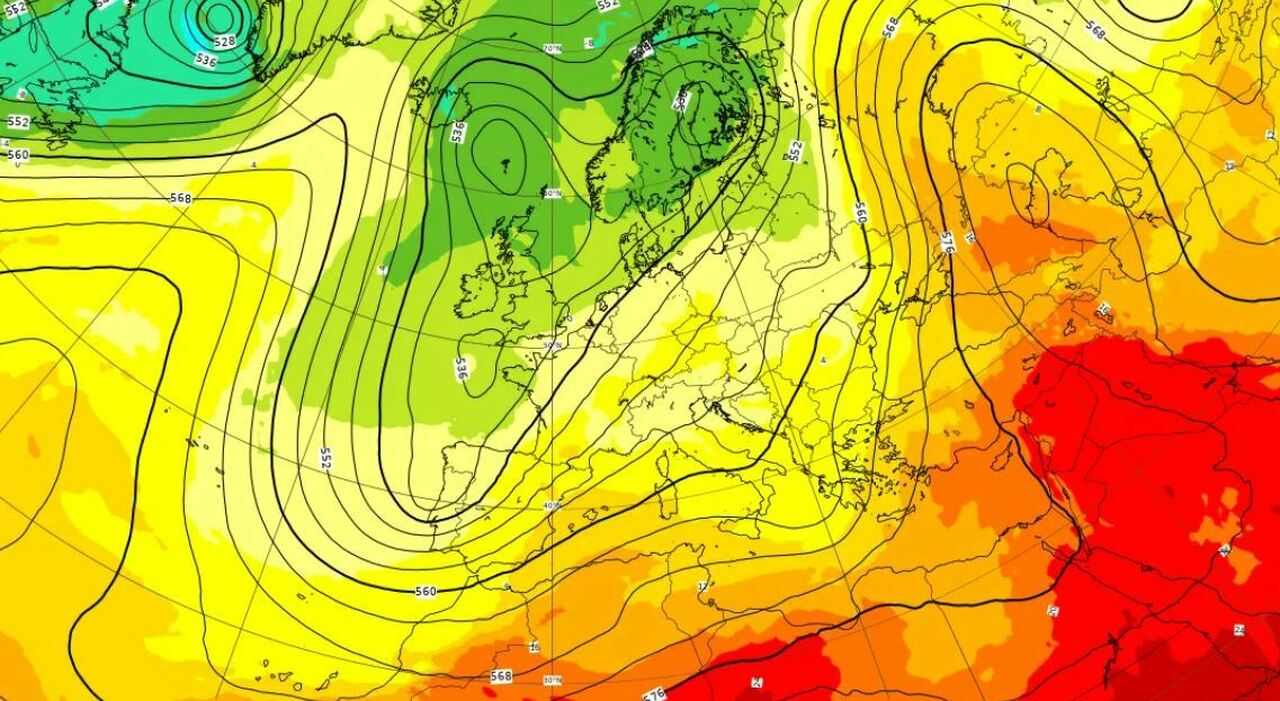
A wave of African heat is coming at the end of April, a real weather swing. Andrea Garbinato, head of the editorial team at www.iLMeteo.it, confirms extreme variability that goes from peaks of unusual heat in mid-month (33°C on April 14th in the North) to recent snowfalls in the hills, and then back up, towards the North African spring climate with 30 degrees in the Central-South, 10°C above the April average. A climate that thus oscillates between North African heat and Scandinavian cold, due to very pronounced North-South meridian exchanges in this period: it is normal to find these synoptic oscillations as the flow of winds is not always directed from West to East or from East to West. Storm Sancho is coming, where and when it will rain. A new drop in temperatures, the forecasts until the first of May. This year, due to the intense cooling of the Scandinavian area during the Winter (down to -44°C), the incursions from the North have been significantly more substantial with snow that has whitened the Alps again, but especially the Apennines up to Calabria around 1000 meters. In the next few hours, everything will change again: the Scandinavian polar air will return home, while an Atlantic cyclone will advance from West to East reaching Normandy during the weekend: this 'Norman' cyclone will favor an intensification of the mild southern currents towards our country. In summary, from today the Italian weather will be increasingly governed by winds from Ostro or Scirocco, from the South or Southeast. The southern winds will initially bring humid and unstable air with some scattered showers, then between Saturday and Sunday (strengthening from the Southeast) they will push intense precipitation at times towards the Northwest: over the rest of the country, the weather during the April 25th Bridge will improve. In detail, in the next few hours, 'transition' showers are expected between the Scandinavian air and the North African air arriving: the showers will be more likely on Liguria, Upper Tuscany, and from the afternoon on most of the central-southern regions in a leopard-spot pattern. It will be a classic spring day with sun, bursts of rain but above all significantly increasing maximum temperatures, everywhere. On Friday, the humid air from the South will still cause some rain showers, especially in the afternoon and in the Center-North. The phenomena will mostly be weak, more widespread in the Center and intensifying towards the Northwest. The Northwest (Liguria, Piedmont, Valle d'Aosta, and western Lombardy) will indeed see a phase of bad weather that will last over the weekend with frequent precipitation and snowfall above 1500-1700 meters: in fact, the zero-degree level is expected to rise sharply beyond 2000 meters in the North, up to 3000 meters in the Central-South. Trend: sunny Sunday except for rains in the Northwest, at times intense. Warmer and clearer phase on Monday and Tuesday then rains on the First of May. From Sunday 28th, the 30 degrees in the shade return.
© ALL RIGHTS RESERVED
This article is automatically translated
